The following are recommendations from the Virginia Department of Health to consider before recreating in freshwater rivers and streams.
https://www.vdh.virginia.gov/waterborne-hazards-control/

The following are recommendations from the Virginia Department of Health to consider before recreating in freshwater rivers and streams.
https://www.vdh.virginia.gov/waterborne-hazards-control/
FOSR’s Summer E. coli Testing Project at public access and recreational use areas on the Main Stem, North Fork, and South Fork of the Shenandoah River and Opequon Creek
Up until the middle of last year, Virginia’s water quality standard for freshwater beach advisories or closures was a single sample maximum of 235 E.coli CFU/100 ml of sample. Virginia no longer has a single sample maximum or any criteria for primary recreational contact in freshwaters.
These are the E. coli concentration results for the water samples that were collected yesterday, Wednesday, June 03, 2020. In a freshwater system, these data represent a snapshot of the water quality on the date, time, and under the conditions that the water sample was collected.
FOSR 2020 Summer Quantitative E. coli Concentration Results through 06.03.2020
FOSR 2020 Summer Quantitative E. coli Concentration Result Manassas Run 06.03.2020
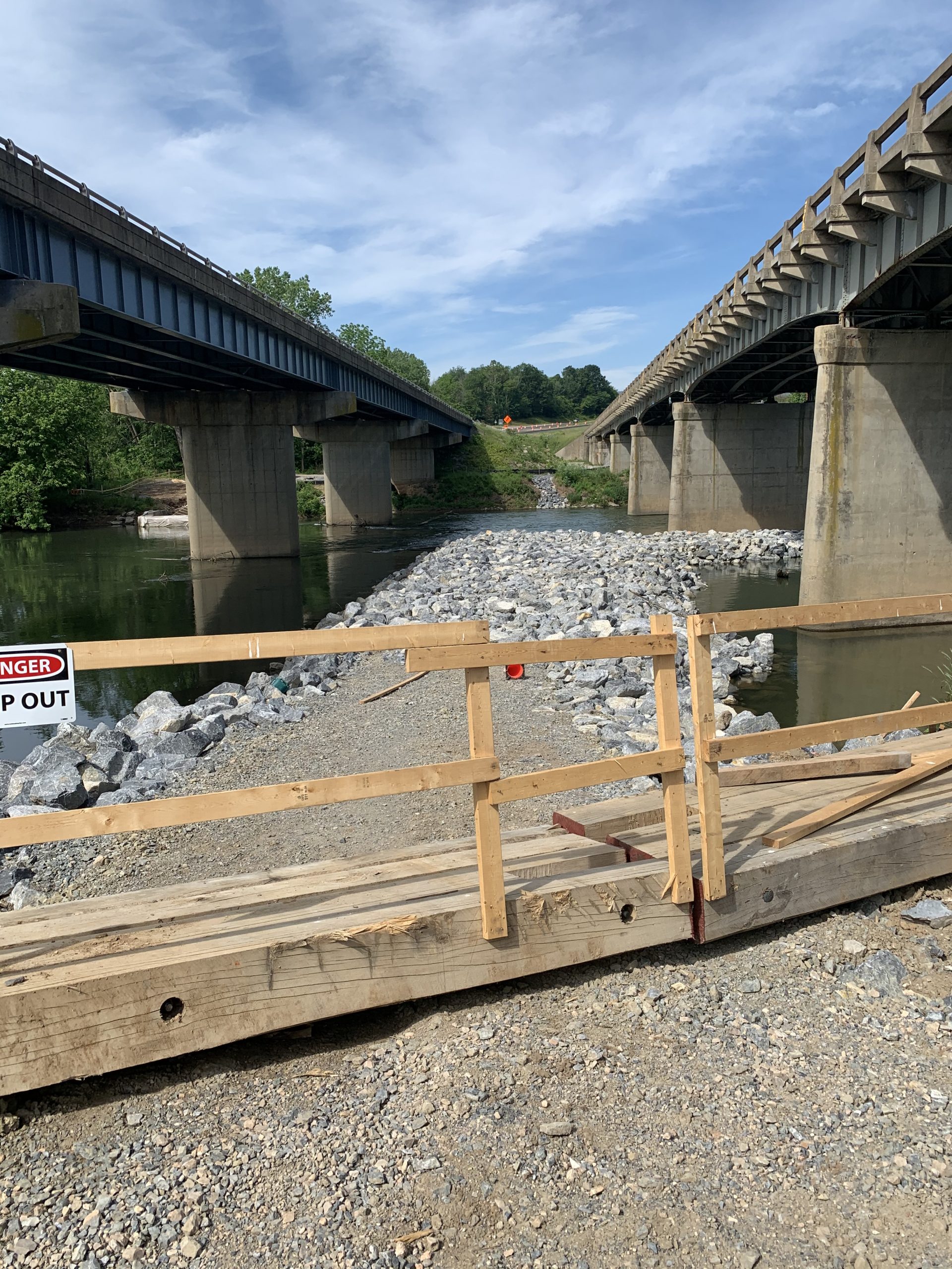
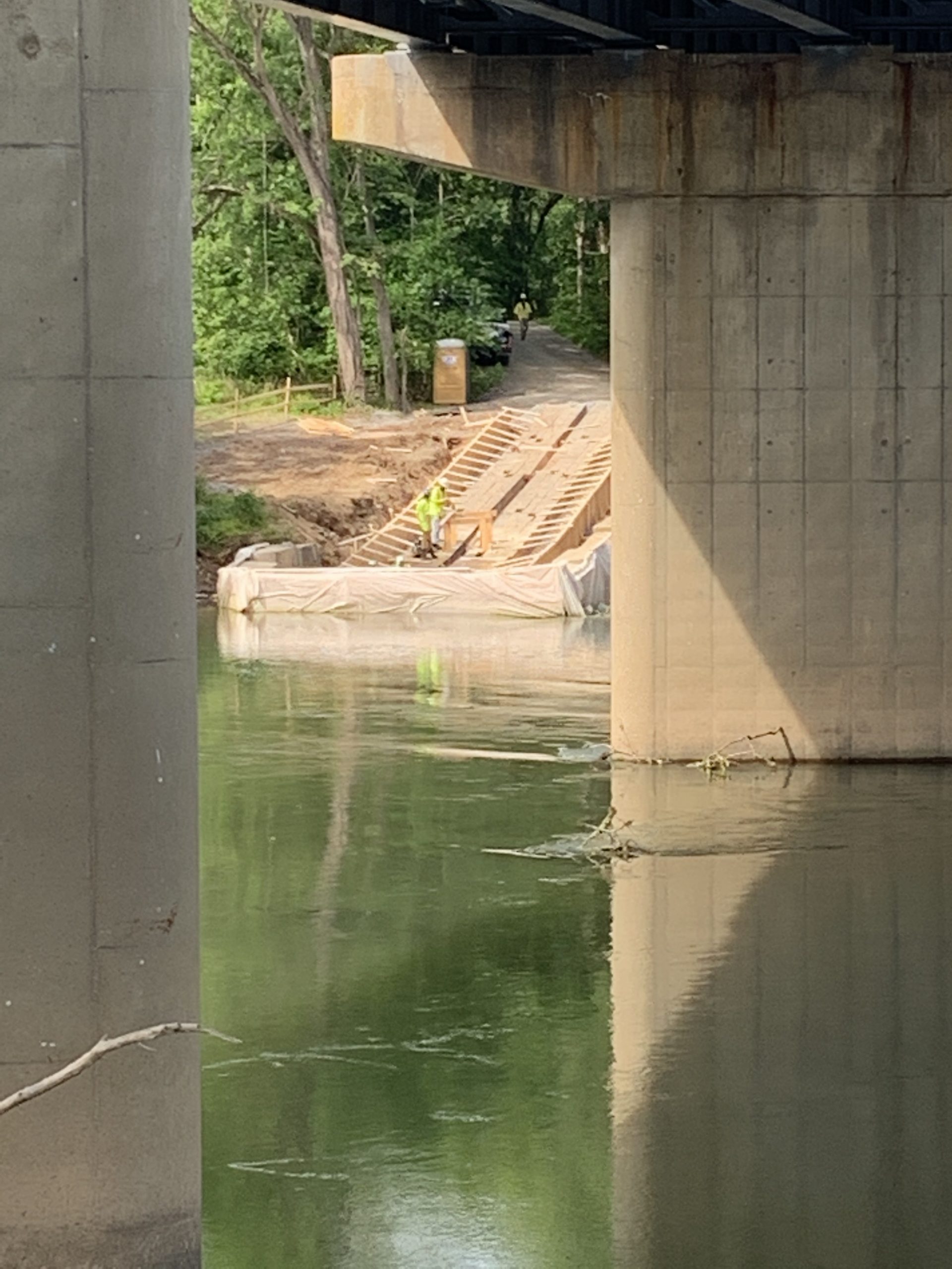
Status of the construction of the partial dam on the South Fork of the Shenandoah River upstream of the current White House public boat ramp in Page County off Route 211 on Route 646 and construction of the new public boat ramp on the opposite side of the river.
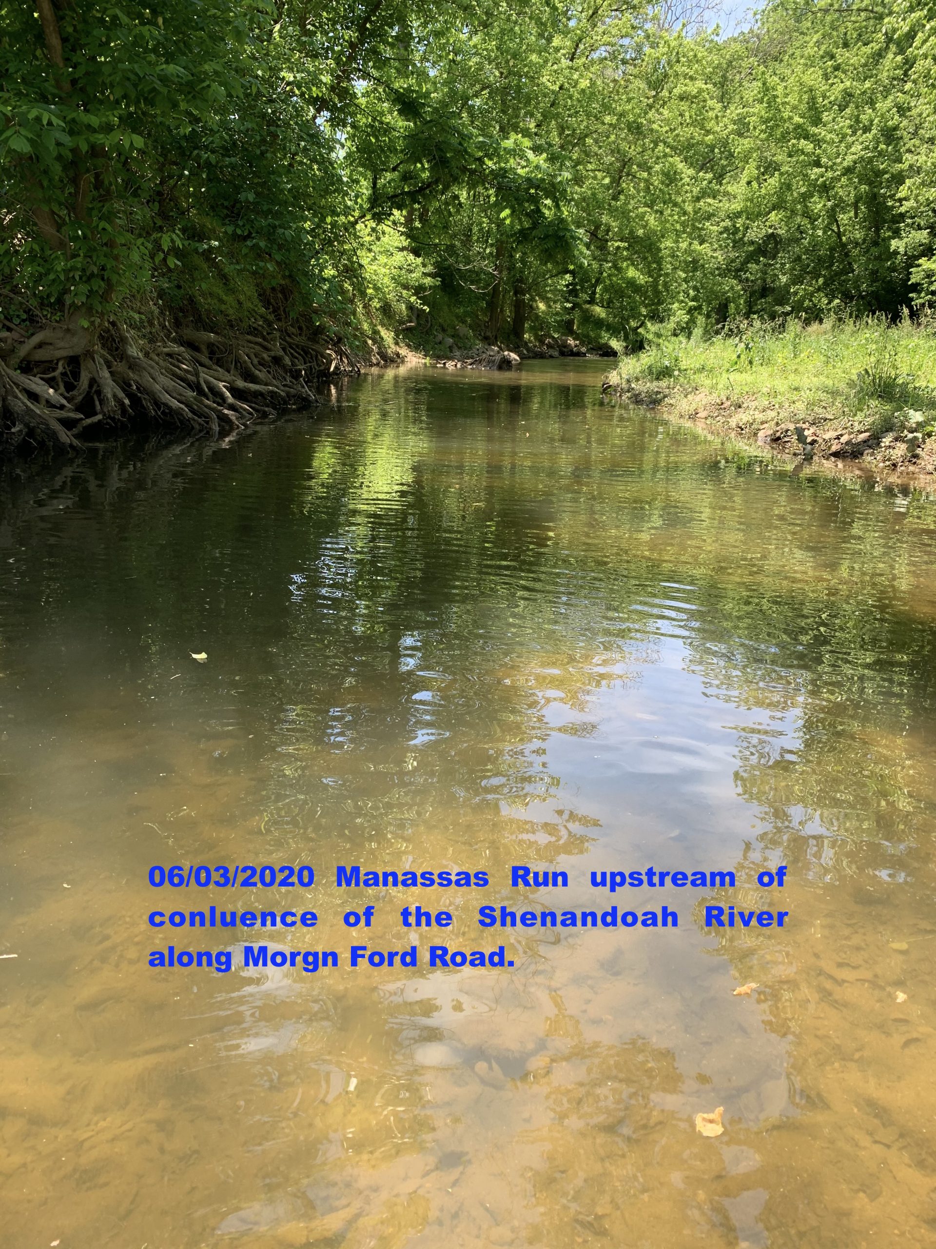
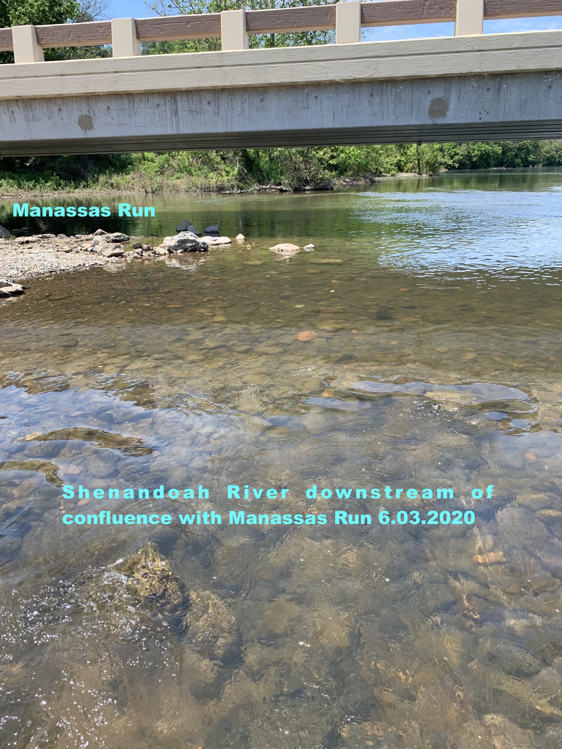
The appearance of Manassas Run upstream of the confluence with the Shenandoah River along Morgan Ford Road and the Shenandoah River downstream of the confluence with Manassas Run at the Morgan Ford Road low water bridge on June 03, 2020.
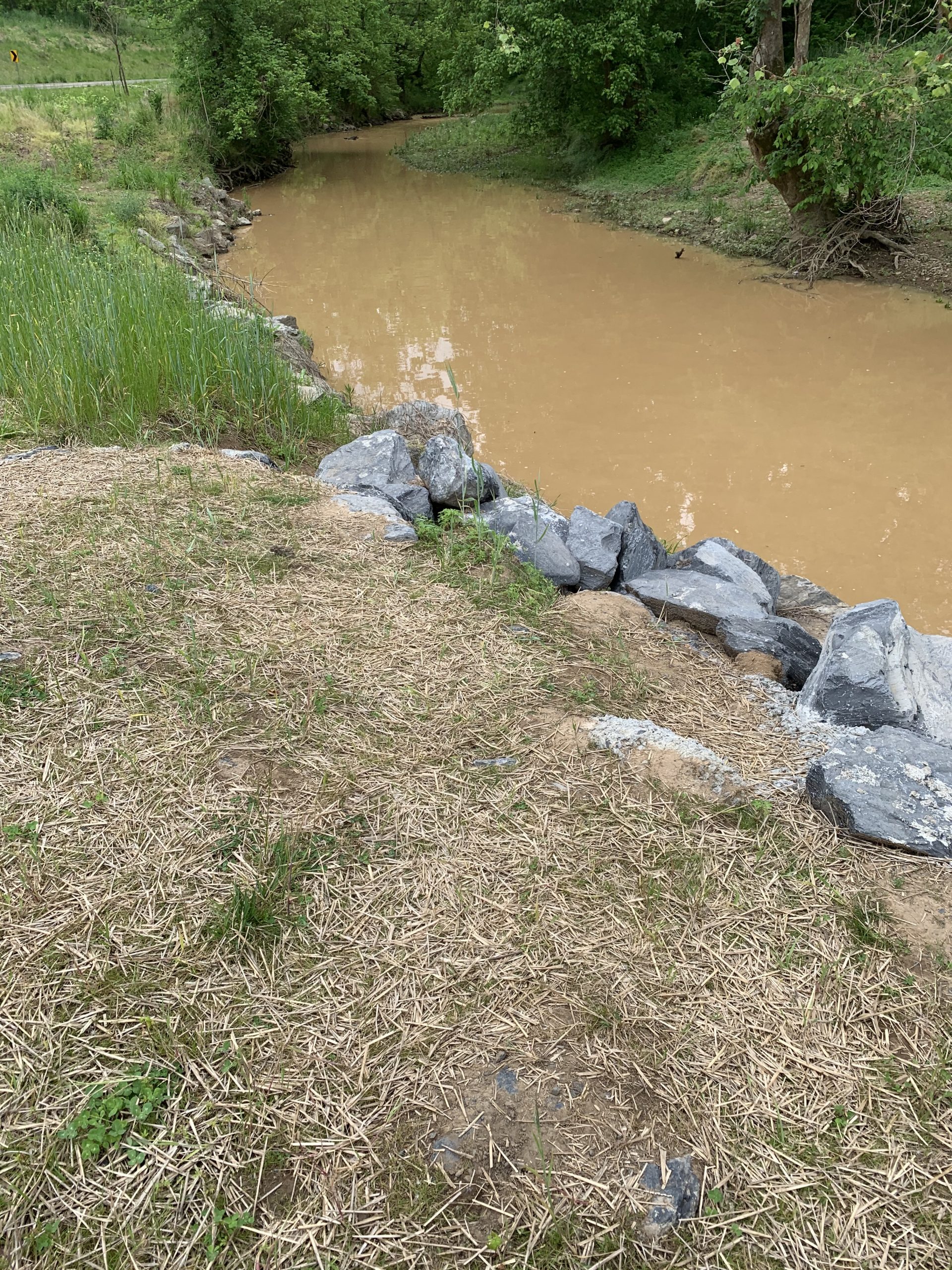
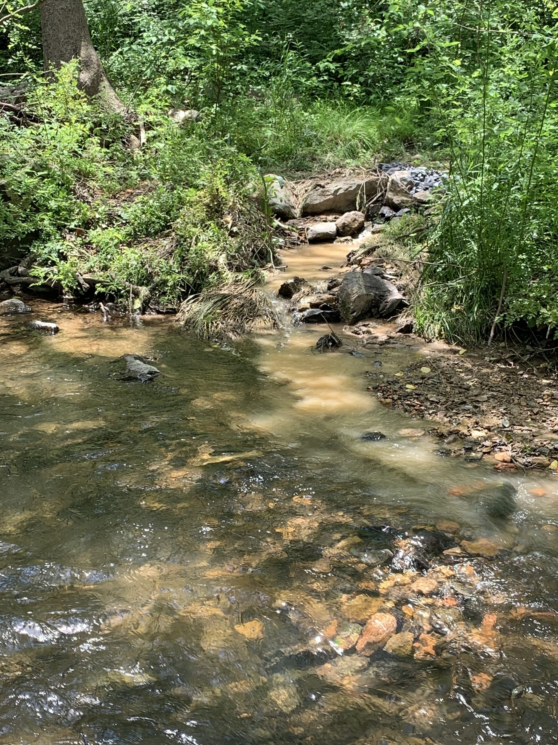
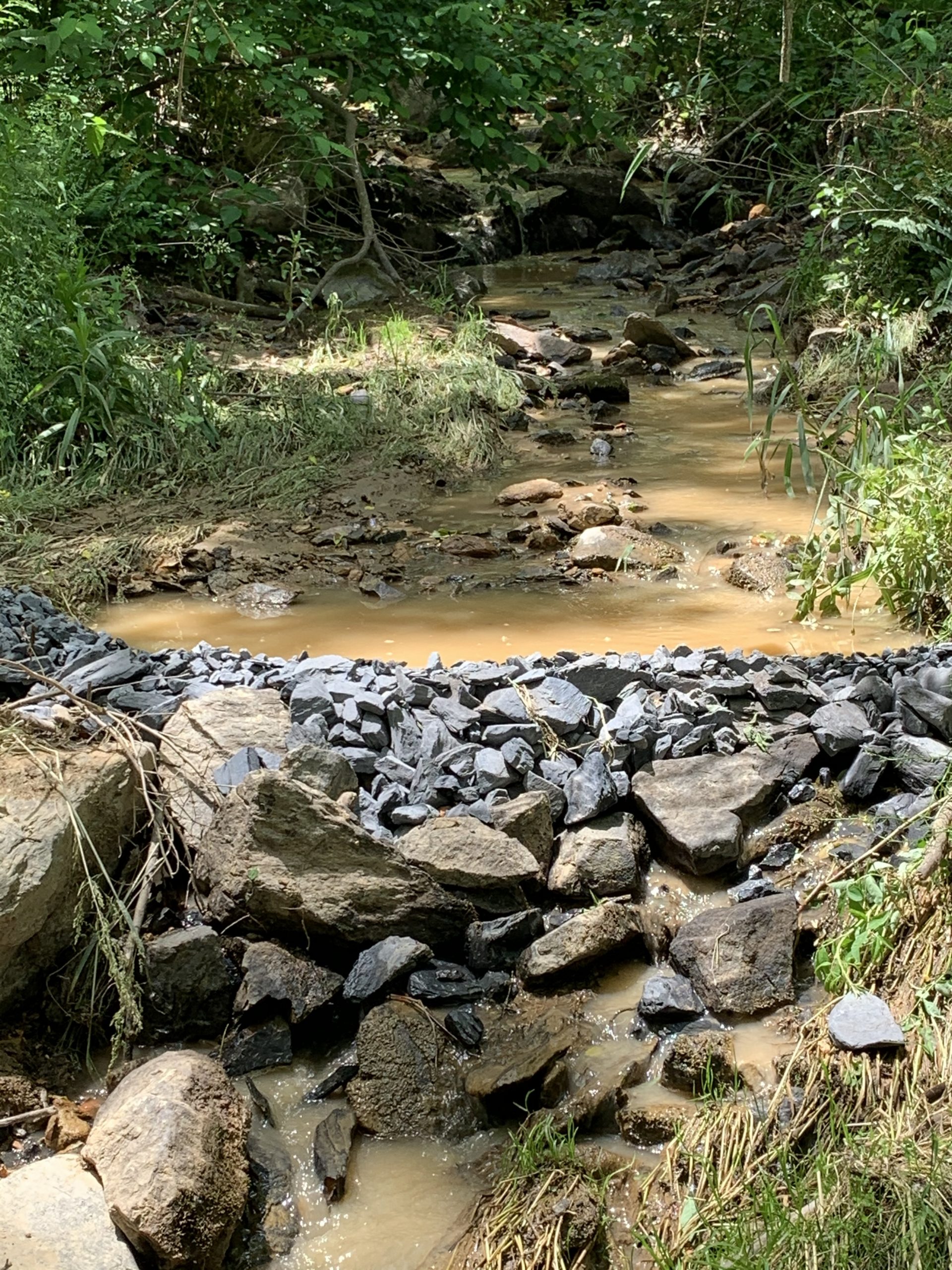
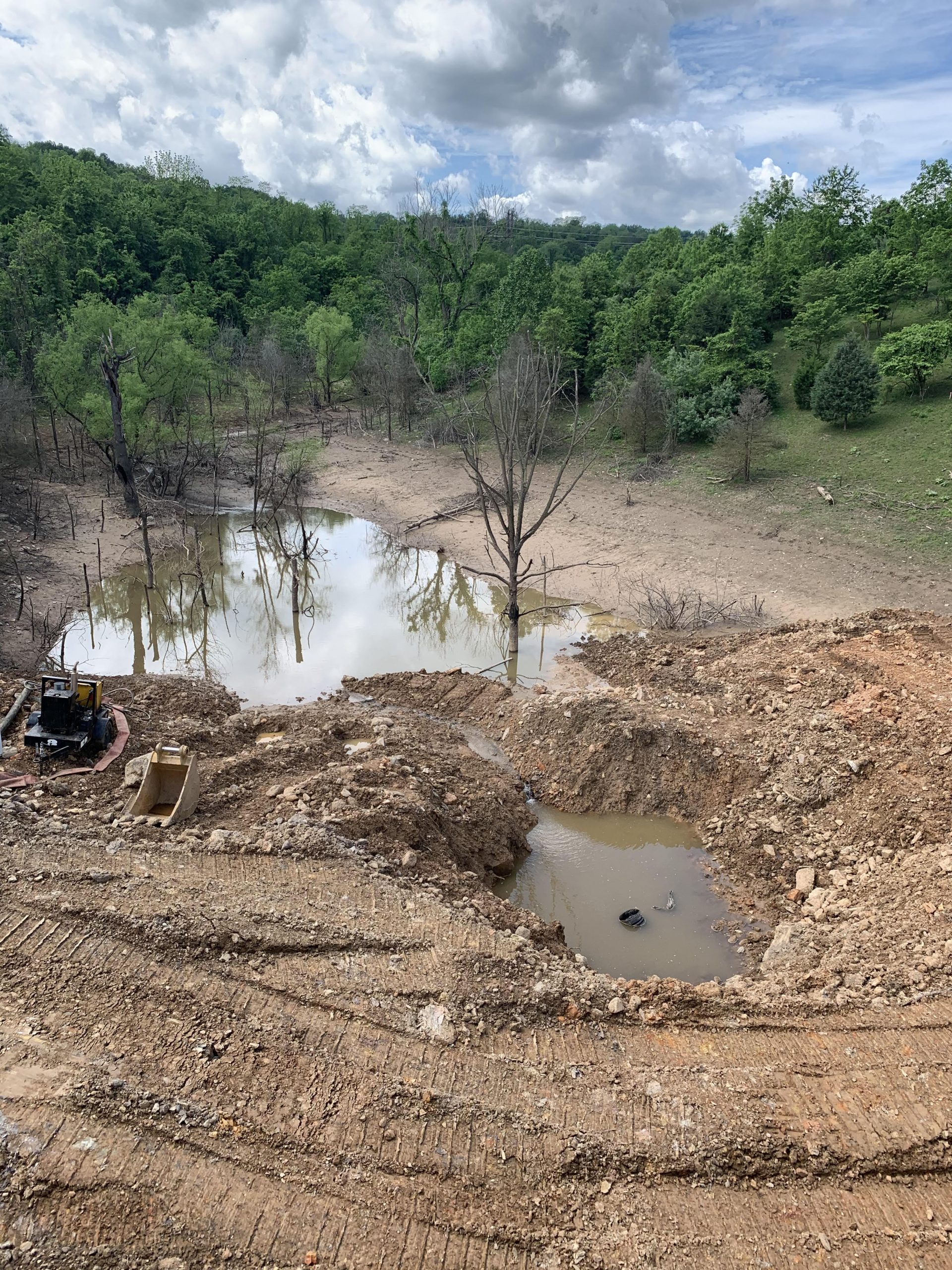
Both Warren County and Virginia Department of Environmental Quality (VA DEQ) representatives have been to the site four or five times of the unnamed tributary contaminating Manassas Run with E. coli, sediment, and discoloration. Warren County and VA DEQ have been responsive, reactive, and open to sharing information. The draining of the containment basin is being done by Norfolk Southern Railroad so that the culvert that handles the overflow from the basin can be replaced. My understanding is that VA DEQ directed Norfolk Southern Railroad to immediately stop the discharge until satisfactory erosion and sediment measures were put in place to stop the discharge of the polluted water into Manassas Run. When I visited the site today I found a berm that was constructed out of rocks and gravel to filter and slow the flow of the discharge. It was not working, as seen in these pictures. While at the site I called VA DEQ. As it turns out, VA DEQ had also been at the site today with representatives from Norfolk Southern Railroad. VA DEQ informed Norfolk Southern Railroad that the berm was not sufficient an additional erosion and sediment measures were mandated.
These are the E. coli results for the water samples that were collected yesterday, Friday, May 29. The E. coli levels of the tributary, site of the high flow laden with discoloration and sediment, feeding into Manassas Run were greater than 2,419.6. The E. coli counts exceeded the maximum detectable limit of the method used for E. coli enumeration. The E. coli levels were lower in Manassas Run above the confluence with the Shenandoah River at the bridge on Morgan Ford Road compared to the levels on Wednesday, May 27. Also, the E. coli levels were lower in the river along the bank of the public boat landing.

I didn’t want to leave you all hanging so yesterday I went out to find the source that caused the influx of sediment-laden runoff that caused the water level of Manassas Run to raise at least 4 inches, maybe more at the peak. Mark Frondorf, the Shenandoah Riverkeeper, and Bill Howard, with the Downstream Project, joined me yesterday in my hunt for the source. Mark is researching to see if any regulations or laws have been/are being violated.
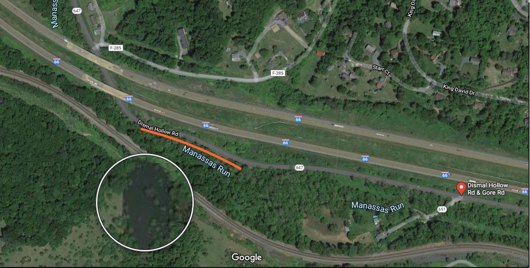
The area circled on the map below is the catchment basin/lake that is being purposely drained into Manassas Run. The runoff contaminated at least 3 miles of Manassas Run and then the main-stem of the Shenandoah River.
While searching for the source, I collected water samples from Manassas Run, the tributary flowing into Manassas Run carrying the sediment, and on the main-stem of the Shenandoah River at Morgan Ford public boat landing on the southeastern side of the bridge. The E. coli results will be posted momentarily.
I have also provided maps, videos, and pictures of this activity to the Virginia Department of Environmental Quality and Warren County authorities.
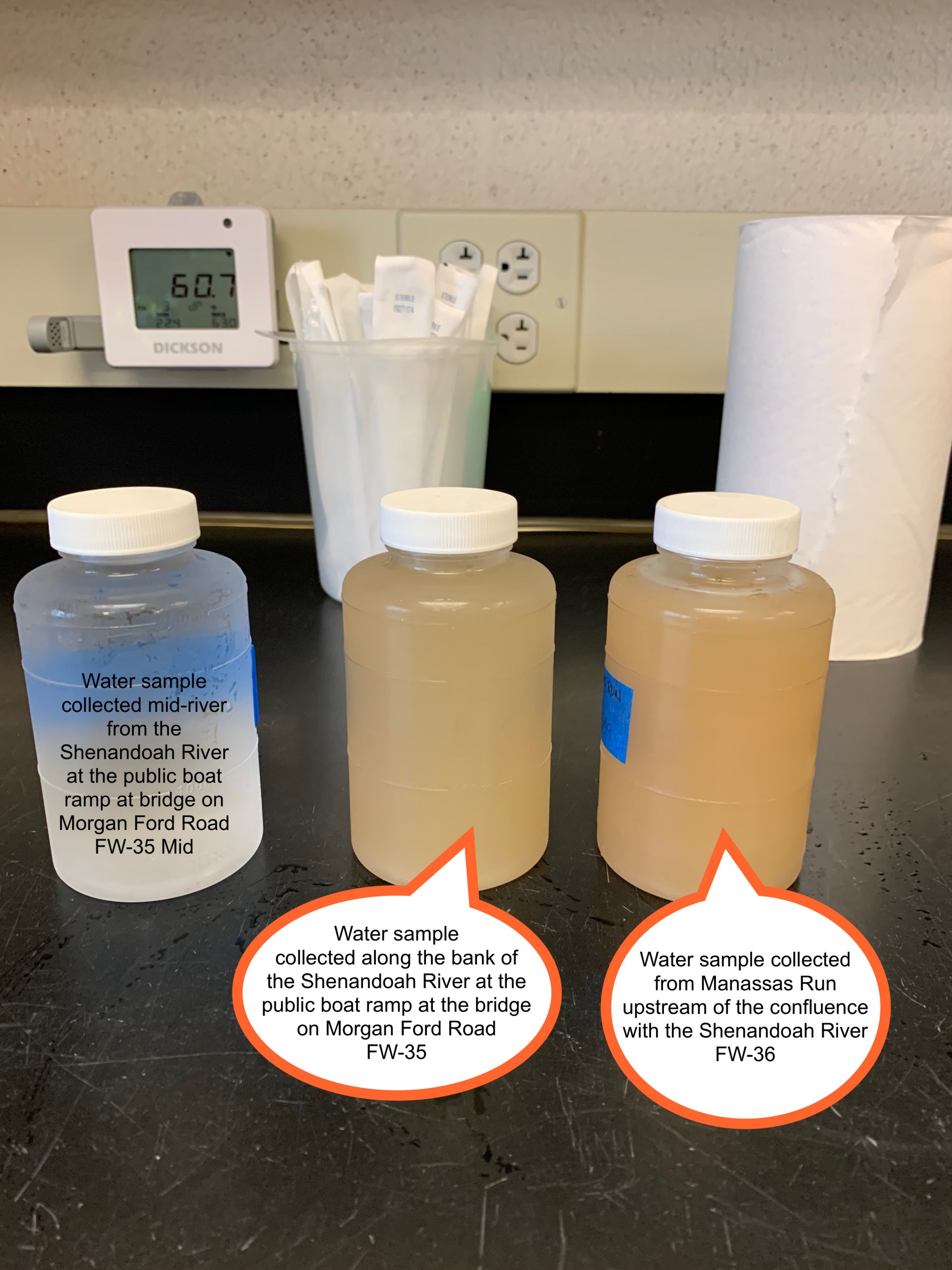
The E. coli results are in for the water samples that I collected and tested yesterday for the FOSR’s summer E. coli testing program. It was more than sediment that was being carried downstream in Manassas Run. The E. coli level in Manassas Run above the confluence with the Shenandoah River at the bridge on Morgan Ford Road was 1,732.9 MPN of E. coli CFU per 100mL of water sample (FW-36). The E. coli level in the Shenandoah River along the banks downstream of the confluence with Manassas Run was 920.8 (FW-35). I also collected a water sample by wading out into the river away from the disturbance. The E. coli level in this sample was 35.9, Shenandoah River mid-stream (FW-35 Mid).
FOSR 2020 Summer Quantitative E. coli Concentration Result through 05.27.2020
The runoff was flowing into Manassas Run along Dismal Hollow Road between Gore Road (Rt. 651) and Gap Road (Rt. F-285). There was enough influx of discolored, sediment-laden runoff into Manassas Run to raise the water level at least 4 inches maybe more at the peak. The runoff contaminated at least 3 miles of Manassas Run and then the main-stem of the Shenandoah River.
The orange line on the map indicates where the runoff was entering Manassas Run. Possibly that is a pond just above the railroad tracks that can be seen on the map. Maybe if it is a pond the retaining wall/dam failed or it was being purposely drained.
I reported this occurrence to VA DEQ and the Warren County authorities.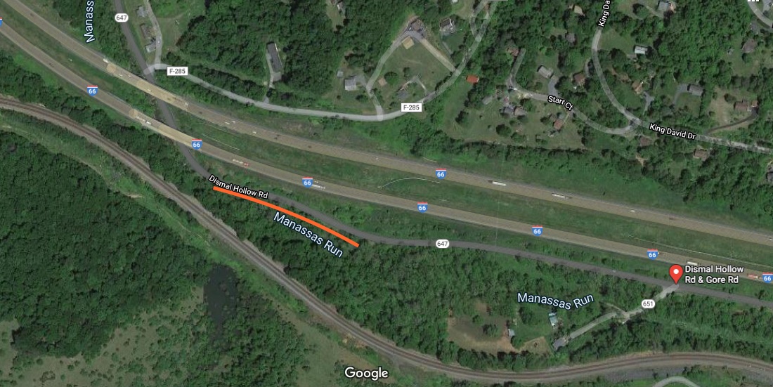
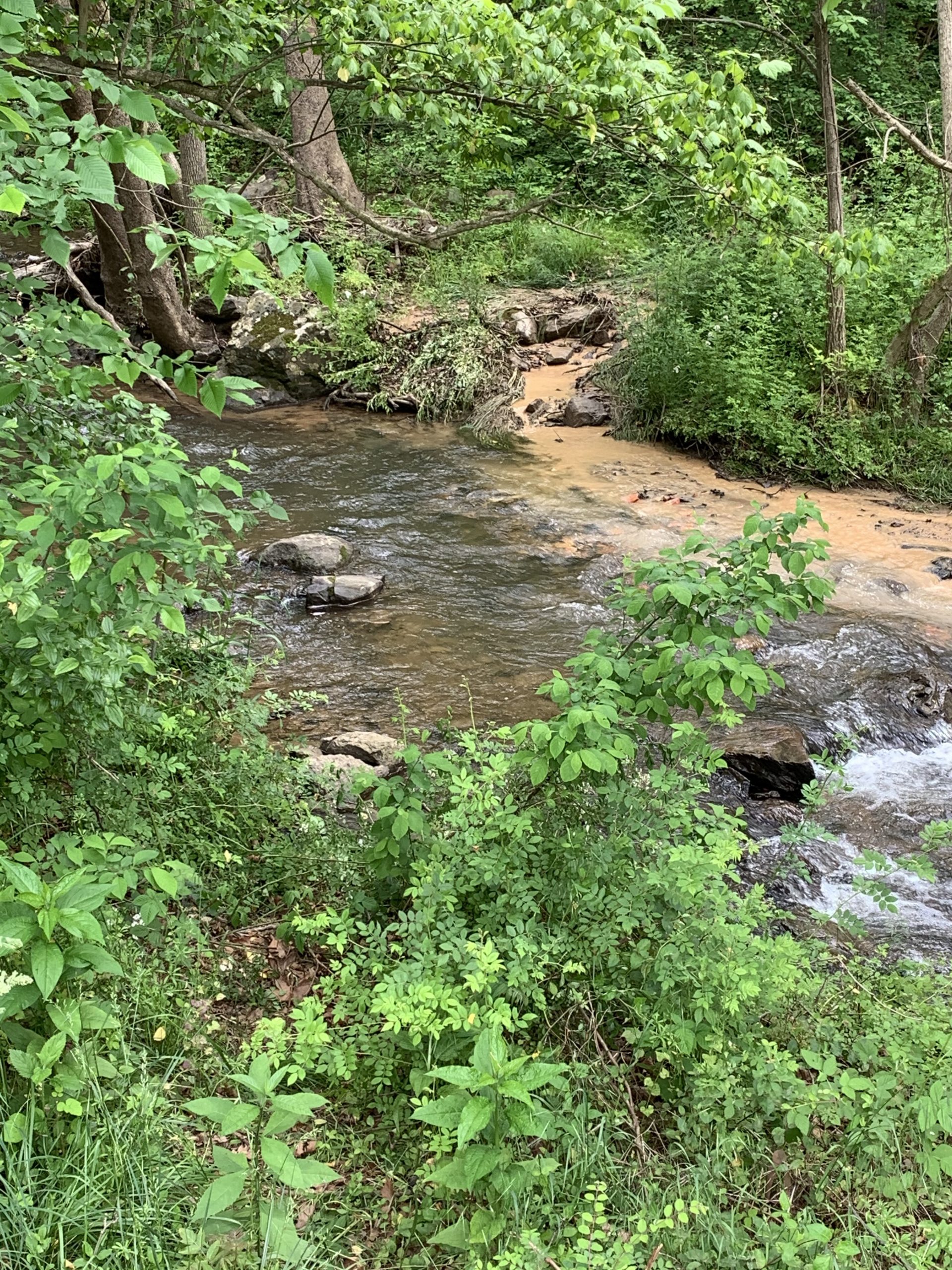
This is what Manassas Run looked like yesterday afternoon when I arrived to collect the water samples. Manassas Run was discolored and laden with sediment as it flowed into the Shenandoah River just upstream of the public boat landing.